LORE is a software being developed in the Department of Economics, Management and Industrial Enginnering at the University of Aveiro in Portugal.
LORE stands for Location Routing Exploration. As the name implies, this software aims to solve both location and routing problems (or even the integrated approach: location-routing problems).
The software is stand-alone and requires the .NET Framework 3.5 to run.
The development was made in XAML for the graphical user interface and in C# for the code-behind.
Altough in its first versions, the software is functional and has been tested on many instances.
The currently supported problem is the Capacitated Location-Routing Problem. Therefore, it also supports specific cases such as the Capacitated
Vehicle Routing Problem (by considering all depots as installed) or the Facility Location Problem (by considering direct paths between depots
and clients).
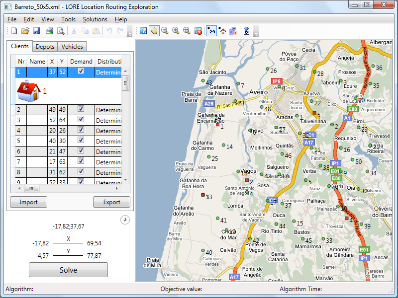
The software supports integration with the Demis Web Map Service (WMS), thus providing real online geographical data.
In the near future other models will be added to the software as well as further integration with other WMS.
In order to request the most recent version of this software, you are required to submit some information.
The required information is strictly for providing support, information on new releases, and obtaining future feedback.
A response will be sent to your e-mail as soon as possible.
Or send an email to rui.borges[a]ua.pt